
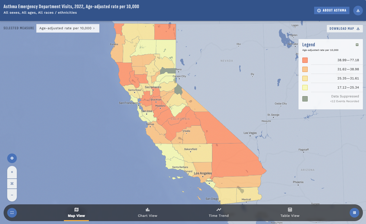
Data Explorer
Search for topics and interact with the environmental and health data for California using maps, charts, time trends, and tables.
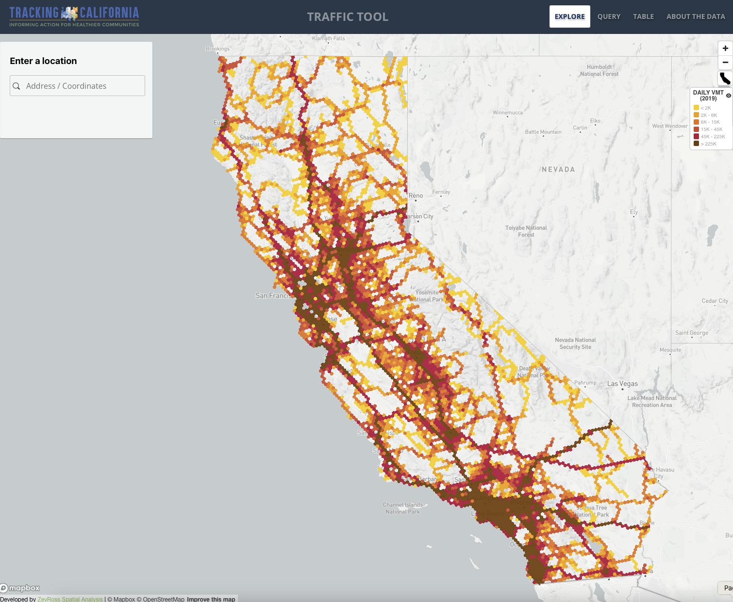
Traffic Tool
Explore estimates of traffic volumes across California. Query data for specific locations and download the results in a PDF or spreadsheet.
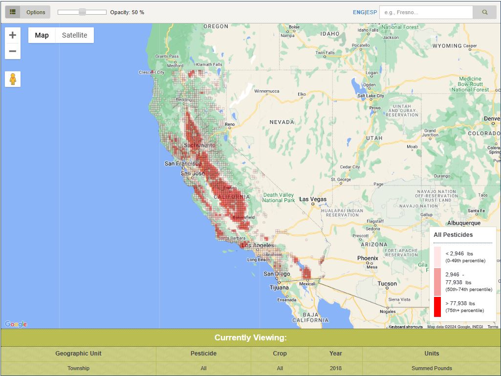
Pesticide Mapping Tool
Visualise and query agricultural pesticides use in California, including type of pesticide, frequency of application, and change in application over time.
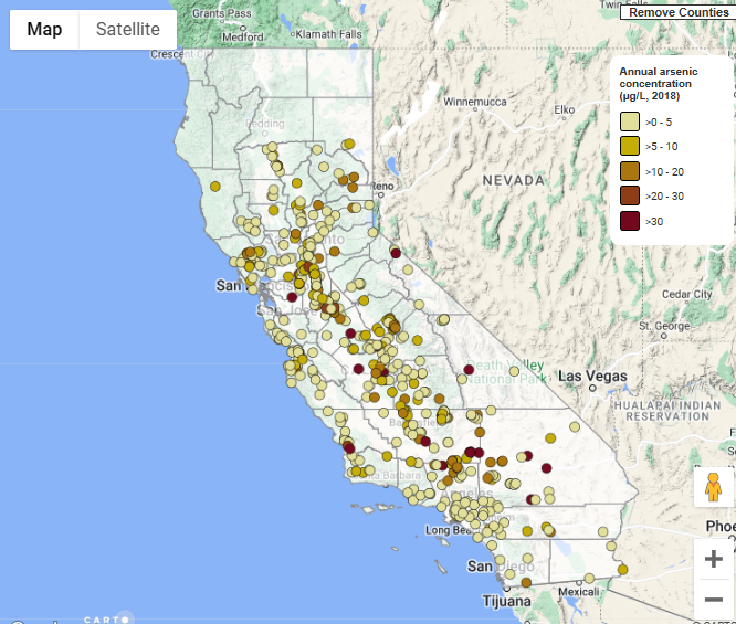
Water Quality Viewer
Track the presence of drinking water contaminants in California and display the levels of certain water contaminants in water systems across the state.
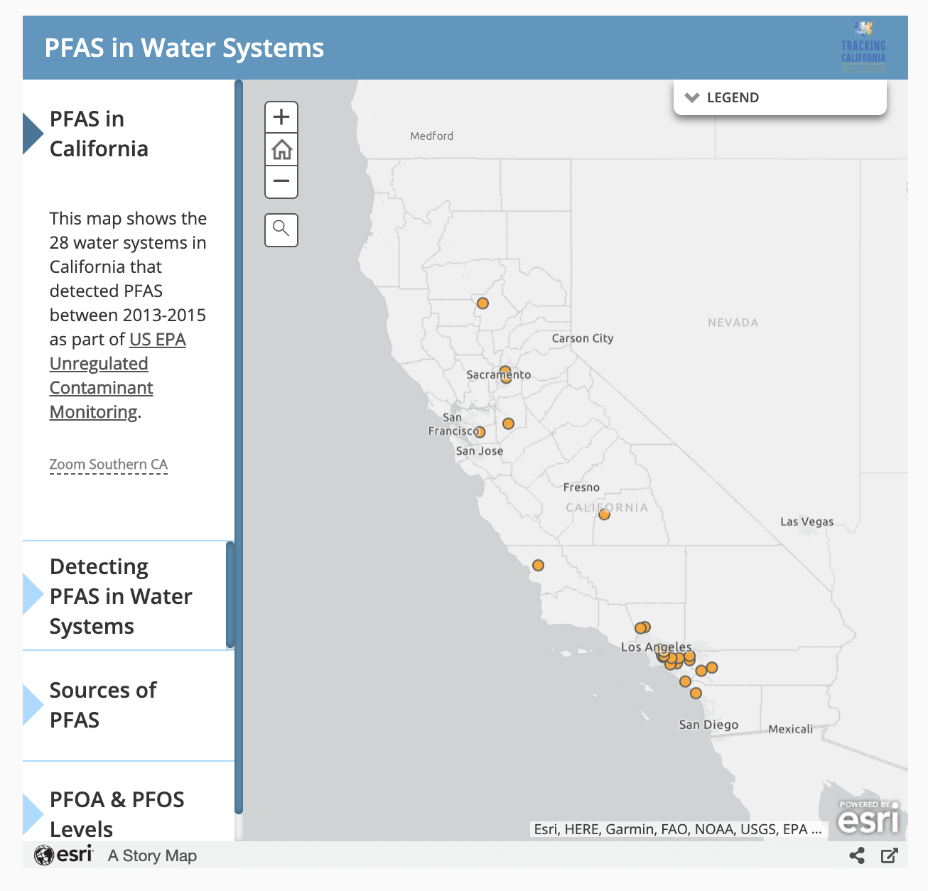
Mapping PFAS in Water Systems
Map PFAS detections and average concentrations across California's Public Water Systems.

Pesticide Linkage Service
Pesticide Linkage Service: High-Resolution Pesticide Data for Environmental Health Research and Surveillance

Hot & Smoky Tool
Visualize recent Hot & Smoky days across California and community vulnerability to these climate extremes at the Census Tract level.